- Ontario, OR to Couer D'Alene, ID via US 95
- Couer D'Alene, ID to Post Falls, ID via I-90
I started out this morning in Ontario, OR, which is right next to the Snake River, the dividing line between Idaho and Oregon in this region. My first step was to cross the Snake River.
And that means I was headed into Idaho.
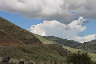
I pick up US 95 as it heads north, up into the hills and then down onto the vast plateaus below. There is a lot of agriculture here, much more than I expected. I was expecting more forests and mountains.
There are forests here, as the highway rises up the various hills and down river canyons to the next plateau. The forests here are typical of interior woodlands, with widely space pines and other evergreens, along with a grassy forest floor.
This is the Little Salmon River, which eventually becomes the Salmon River. I took this shot high in the Salmon River Canyon. There are a million rapids and rocks, thousands of waterfalls, eventually taking this water to the Snake, then the Columbia, then the Pacific Ocean.
The Salmon River is famous for, well, salmon fishing. These folks are all camped on one side of the road so they can go fishing on the other.
The Salmon River as it heads through the lower Salmon River Canyon. It's also popular for boating and white water rafting.
This is a look down White Bird Hill, a place of some significance to the Nez Perce Indians who populated this region before the white man took the land from them.
These historical markers are all along US 95. This one explains the importance of White Bird Hill.
This is a look up the grade of White Bird Hill. There was an older road before this, with all kinds of turns and switchbacks. Now the new highway makes the hill steeper, but faster.
If you are interested in this stuff... (Mike George, read here.)
On the other side of White Bird Hill you come down onto another wide open prairie. This happens a lot along US 95.
Another Historical Marker, if you can read it.
On the other side of Camas Prairie, you go through another canyon. If you look very closely in the center of the picture you will see a trestle bridge.
Here is the what-for on that bridge.
At Lewiston, ID, the Snake River takes a sharp left turn. That turn is where the Clearwater joins the Snake. One one side of the river is Lewiston, ID. On the other side of the river is Clarkston, WA.
Here is a bit of history about the rivers, if you are interested, and can read the fine print.
That road snaking down the hillside below is the old highway, built when the grade had to early automobiles.


One again, the Oregon History Association provides some interesting details about the road.
Cougar Bay on Couer D'Alene Lake. This is more what I expected of Idaho; trees, mountains, lakes.
I have almost arrived. While my general target was Couer D'Alene, I am staying in Post Falls at the Red Lion on the Spokane River.
In order to get there, I had to cross said river.
This is the evening view from the patio of my room. That is the Spokane River . There are boats here. I like that.


No comments:
Post a Comment