Travel Day
- Fort Nelson, BC to Hudson's Hope, BC via BC-91 and BC-29 (Alaska Highway and Don Phillips Way)
- Hudson's Hope to W.A.C. Bennett Dam and return via Canyon Road
- Hudson's Hope to Chetwynd, BC via BC-29 (Don Phillips Way)
It's an easy road coming out of Fort Nelson, long straight stretches, easy curves well banked, the kind of drive that could, and almost did, put me to sleep. The flowers are still pretty, though.
There was one point of the drive to Fort St. John which provided a modicum of excitement, near Prophet River. This fire is one of the many which has ravaged BC of late; it's barely out, still smoldering in a great many places.
There are plenty of hotspots for the fire crews to work on. The fire may be mostly out, but it is still active and will be for a while yet.
As you leave the Fort Nelson region you move into the Peace River region.
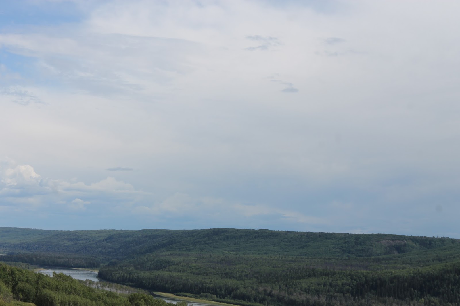
Rather than go through to Dawson Creek, we took an alternate route, down Highway 29 along the Peace River.
The road rises and falls from the valley floor several times offering tremendous views of the Peace River valley and surrounding agricultural land, land that will be lost to the Site C project should it proceed.
We arrived in the small town of Hudson's Hope, the home of, or at least the nearest town to, the W.A.C. Bennett Dam.
As we headed past town towards the dam, this little deer was happily munching away on the bushes at the roadside. I know, these little critters are almost everywhere. But they are still cute. Tasty too!
We have arrived at the
W.A.C. Bennett Dam. This project has been a part BC for my whole life. The dam was conceived before I was, designed while I was in diapers, and finished in the first year of my teens.
We drove across the dam to the viewing site before doing anything else. I really wanted to drive across this dam.
The viewing site has explanatory signs describing the site before, during and after construction.
From the viewing sit you can get a good look at the face of the dam with the Peace River flowing out of the base and into the Peace Canyon, headed for the second generating station down river.
Another look at the canyon as the water heads out.
It's hard to imagine the scale of this project. The dam, when it was built and to this day, is one of the highest earth filled dams in the world. It's a full two kilometers across the dam, and it holds back the third largest man-made lake in North America.
A look back at the canyon from the top of the dam.
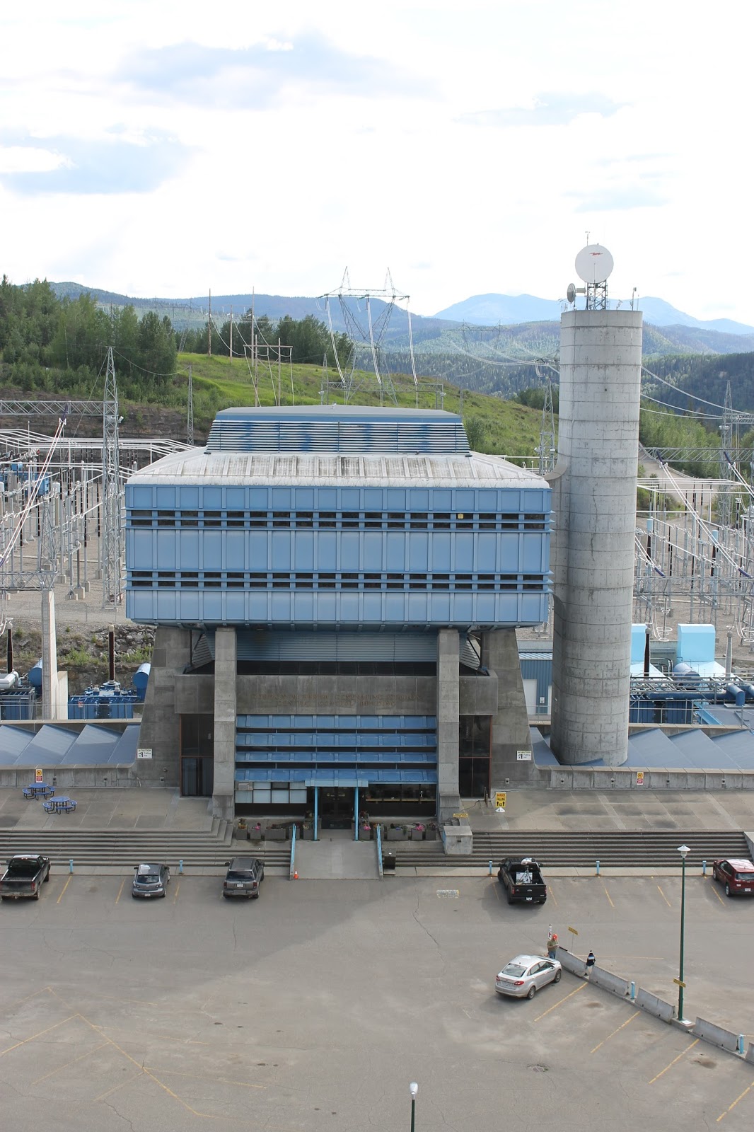
The generating station control building and the substation for the dam.
This building, rather futuristic looking when built in 1968, is the control center for the dam and the power control systems.
After taking a look at the dam, we went to the nearby Visitor's Centre. Unfortunately it closed just as we arrived. No matter,there are more pictures to be had here.
The gateway to the path round the centre.
A look back at the dam from the Visitor's Centre.
Yep, that's me. Yep, that's my truck. Yep, I was there.
There is a fair bit of security in place here. No surprise. This place produces a quarter of all BC's electricity requirements.
We headed back to Hudson's Hope and across the Peace River. The Peace Canyon dam and generating station are just upstream from the bridge and town.
About 40 minutes later we arrived in Chetwynd.
Chetwynd is a lumber town, with the Canfor mill being the main employer in the region.
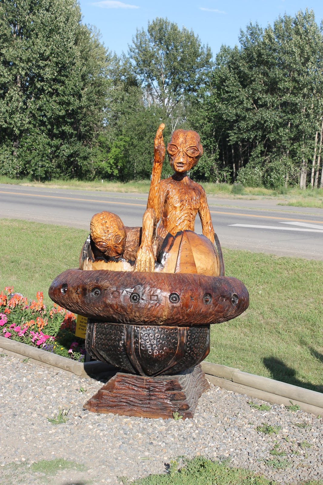
As might be appropriate for a logging town, Chetwynd is filled with chainsaw sculptures.
They come in almost every design and size, and are spread about the town.
Here is one of several tableaux settings, this one doubling as a welcome sign.
The subjects range from those reflecting life and activities in the Chetwynd area...
to those which are a bit more fanciful, even surreal. Yes, those are aliens.
This is a new place here in Chetwynd, open for about a year. The town finally has a decent restaurant and bar!
One last look at the row of chainsaw carvings lining Highway 97 as it makes its way through town.