- Dawon City, YT to Eagle Plains, YT via The Klondike Highway and The Dempster Highway
We headed up the Dempster Highway today, the only road in Canada to cross the Arctic Circle. It's 775 km of dirt highway, well packed but dusty when dry and muddy when wet.
In other words, "Abandon hope all ye who enter here."
First we had to cross the Klondike River, just as the highway starts. Fortunately there is a bridge.
The road ends and the gravel begins fairly quickly after crossing the bridge.
This is the Tombstone Interpretive Center in Tombstone Territorial Park. This centre explains the northern environment to visitors. It'a about 74 km up the highway.
There seems to be no end of inuksuk up here.
We stopped at Two Moose Lake, but we saw no moose whatsoever.
The Ogilvie is one of the main rivers up alongside the Dempster. The highway follows it for some time.
You can see the water from Red Creek as it mixes with the clear water of Ogilvie River.
Ogilivie Ridge overlooks the Peel River, and a ton of territory.
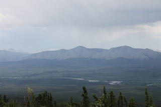
Just a part of the massive countryside up here, as seen from Ogilvie Ridge.
The highway generally follows the high ridges along the mountains, giving some fabulous views. You can see forever up here.
We ended the day at the Eagle Plains Hotel in Eagle Plains, YT.
It's actually a fairly large installation with the hotel, restaurant, lounge, and gift shop. There is also a gas station here.
At the back of the hotel is a viewing stand to look down into the valley below. Apparently you can see moose and bear here on occasion.


Happy to hear you are okay and still enjoying your trip. Love you
ReplyDeleteMom