- Eagle Plains, YT to INuvik, NT via The Dempster Highway
Shortly after leaving Eagle Plains, you cross the Rat River, famous for the Mad Trapper.
The Dempster Highway retains is character, running along the high ridges, visible for miles ahead.
Katherine got a bit excited when she saw this sign.
And here she is, at the Arctic Circle.
Yep. Yep. Yep.
The view of the landscape at the Arctic Circle. Tundra mostly.
Once again the Dempster Higway rolls on and on into the distance.
We finally get to the NWT, and lose an hour for our efforts.
It's the arctic. What would you expect here?
Crossing the Peel River by ferry. The landings are dirt. The ice on the river destroys them every year. If the government put in a permanent one, the ice would likely destroy it as well. The ferry works for summer. Then, after freeze up, the ice bridge works.
This is the inside of the Nitainlaii Visitors Center, just up the hill from the Peel River. This fellow is the host. The center contains information about the Gwich'in natives in this area.
We arrived at Fort McPherson to see the welcome sign.
Then we saw this sign right beside it. No doubt, this is a dry town.
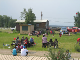
Canada Day in Fort McPherson.
The Peel River Inn and Gas Bar.
Across the Arctic Red River, where it joins the Mackenzie River, is the village of Tsiigehtchic, a Gwich'in settlement these days, but originally founded by the Catholic Oblate Missionaries.
Welcome!
Yep. Yep. Yep.
One of the locals with her ATV decorated for the Canada Day celebrations in Tsiigehtchic.
The ferry across the Mackenzie River. Did you know that the Mckenzie is the third largest river in the western hemisphere, behind the Amazon and the Mississippi? Did you know that it drains fully 1/5th of the Canadian land mass?
We made it to the end of the Dempster, here in Inuvik.
It's been a long, dusty, dirty drive. My truck needs a wash, but it doesn't make a lot of sense. We are going back in two days.


No comments:
Post a Comment