Thursday, May 21, 2015

Nevada, Oregon, Idaho, And Oregon Again

Travel Day

  • Winnemucca, NV to Ontario, OR via US 95 and I-84
This is what the Nevada desert really looks like, without the rain. Lots of rocks and sage brush.

The mountains off in the distance are even drier. Their hard scrabble shells of sandstone and igneous rock maintain no moisture, in spite of the heavy rains yesterday. The only thing in those sullen rocks worth having is the gold and silver deep within.

It is possible to make the Nevada desert green, but it takes an awful lot of irrigation. There is already a battle going on between the cities and the farms over the diminishing auquifers and groundwater supplies.

After a couple of hours of driving through the Nevada desert, I got to drive into the Oregon desert. Note the street name.

As you move north on US-95, the landscape gets greener, Then after a while you come across the canyon of the Owyhee River. That's the canyon edge up there.

And you leave Oregon, just after you enter Owyhee country.

Welcome to Idaho. Redundant, I know.


You move up the canyon of the Owyhee until you reach the top where you can see the Snake River valley in the distance.

Here is why it is called Owyhee country.

Down the canyon wall and into the Snake country.

I am headed for Ontario, only this time it is a city in Oregon, not a province in Canada.

Ontario is just on the other side of the Snake River, which, in these parts, is the border between Oregon and Idaho. I am back in Oregon for the night. My first turn tomorrow morning will take me back over the Snake River and once again I will see a thank you sign.

Wednesday, May 20, 2015

Sacramento, CA To Winnemucca, NV

Travel Day
  • Sacramento, CA to Winnemucca, NV via I-80
On leaving Sacramento and heading east on I-80, you get up into the Sierra Nevada mountains in just over an hour. The uphill climb is steep. The forest is widely spaced pine with plenty of detritus on the ground, perfect for the kind of wildfires that happen here every year.
 

I had just gotten up into the high country when the rain hit. It was coming down pretty heavy.

That white stuff on the ground is hail. The storm was intense and continued for a long way.

Shortly after the rain started I arrived at the infamous Donner Pass.

The terrain up here at the summit is pretty rough. It's easy to see how the Donner Party got stuck up here in the winter of 1846.

The summit isn't even the top. The Sierra's go a long way up from here. That's snow up there.

Looking across the Donner Lake valley you can see the Donner Pass road, This road goes even higher, up into ski country. This is one of the bridges.

This picture is for Mike George. That is one heck of a road embankment.

I made it to Nevada. The weather is still bad; rainy, stormy, thunder, lightening, hail.

The countryside here is lower, and drier... even with the rain.

I had to pull over at one point. The rain was so heavy I needed to rest for a while. Those white flecks are hail. The ground is soaked. It wouldn't surprise me if there was some flash flooding.

That white stuff beside the road is hail, still. Off in the distance the sky looks clearer, but it was rainy all the way to Winnemucca. I am thinking people around here don't mind. It's a desert, after all.

Tuesday, May 19, 2015

San Francisco to Old Sacramento

Travel Day

  • Explore San Francisco via various roads
  • San Francisco, CA to Sacramento, CA via I-80
I started my day with another bit of exploration around San Francisco. First stop, Ghirardelli Square, home of world famous Ghirardelli chocolate. This is where I stopped for ice cream with Burhan yesterday.

While taking the picture of the square, I noticed this boat. It's been down there in the harbour for as long as I remember. I wonder what it is?

These are the "Painted Ladies", a group of beautifully painted Victorian homes beside Alamo Square. Many people refer to them as the Full House houses because they were featured in the opening establishing shots of the TV show. However not one of these is the actual Full House house.

This is the actual exterior shot of the Full House house at 1709 Broderick Street. Even this is only an exterior establishing shot for the show. The actual show was filmed in Hollywood.

I've been here before. I think I can remember it. I know it wasn't in the '60's. It might have been the '70's, or perhaps even the '80's. It's all a bit of a blur. My memory fails me. Does anyone have some chips?

The neighbourhood still looks pretty cool though. Funky!

This is the cathedral on the top of Nob Hill. It is the Grace Cathedral, an Episcopal cathedral.

This is the California Masonic headquarters. In spite of its neo-classsical look, it was built in 1958. It, too, is on the top of Nob Hill.

Also on the top of Nob Hill are four of the ritziest hotels in San Francisco. This one is the Fairmont, the original Fairmont.

I'm sorry. It parked in front of me. I had to stop, and since I was there...

As you go down the other side of Nob Hill, China town is at the bottom. It's actually a fairly big neighbourhood.

I went from Chinatown across the Bay Bridge. This time, for the first time ever, I took the turn onto Treasure Island and Yerba Buena Island. This is a shot of San Francisco from Treasure Island.

Treasure Island is actually a man-made island. The original island was Yerba Buena. Treasure Island was seized by the US Navy in WWII. Then they closed the base in 1997. Most of the military buildings are abandoned now, like these Bachelor Enlisted Quarters.

Looking from Treasure Island at the new, east section of the Bay Bridge. That's Oakland off in the distance.

Even though the buildings are mostly abandoned, there are still remnants of the Navy past lying around.

Even the Officers Quarters, and the Base Commander's Quarters are empty. It;s kind of a military ghost town.

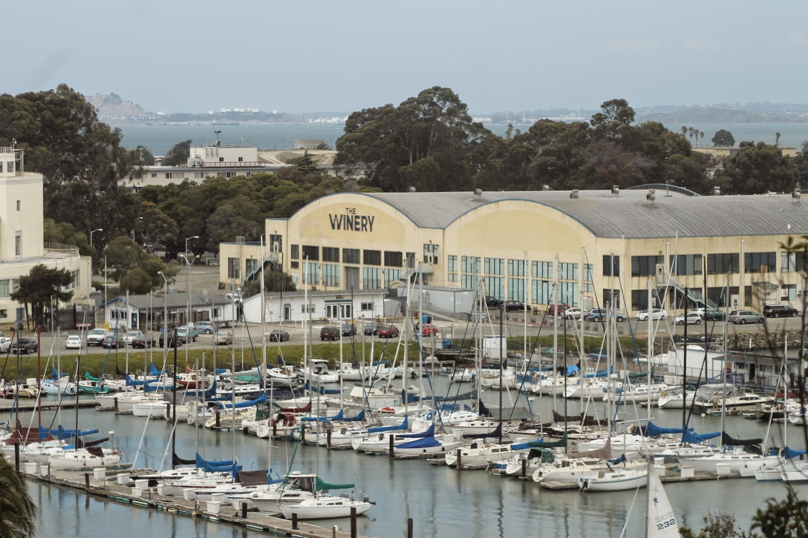
Even with the abandonment, a number of the buildings have been reclaimed and re-purposed. Here one of the hangers has been turned into a winery.

I left San Francisco and drove the 2 hours up to Sacramento, the state capital. Here is the Capitol Building.

I am not sure if this is the Supreme Court of just Legislative Offices. All three, the Capitol, the Court, and the Offices, are clustered around a roundabout.

Old Sacramento. Very old. Very cool. Lots of fun. I come here every chance I can get.

The sidewalks are really old west. This is not fake. This is how it was when the town was selected as the end point for the Pony Express.

I went up to one of my favourite Tex-Mex restaurants and had a Margarita with dinner.

I finally made it back to the Delta King. This is the lobby.

And this is the night view from my stateroom. That red thing is the paddle wheel of the boat. That's the bridge over the Sacramento River in the background.

Monday, May 18, 2015

Wandering About San Francisco

Travel Day

  • San Francisco, CA to Fremont, CA and return via various local roads, I-880 and US 101

Today I did a bit of touring around San Francisco, after which I met a friend for ice cream at Ghirardelli's in Ghirardelli Square. My tour plan was to do as much as I could of the 49 Mile Scenic Drive in San Francisco. It is a drive that takes you to most of the sights to see in the city. However, in my own personal style, I intended to follow it backwards, so the sights were on my left, so I could take pictures without getting out of the truck. More on this later.

My first stop was Lombard Street, locally claimed to be both the twistyest street in the world, as well as the steepest. Unfortunately neither claim is true. What is true is that this is a very picturesque street and a very poplar tourist attraction here in San Francisco. 

Having been at the bottom, I drove round the block and made the requisite trip down the hill. It has lots of signs which say "No Stopping". I stopped to take this picture. So sue me.

As you know, Lombard Street is not the only hill in San Francisco. This is the view up Lombard, looking east. That hill out there is Telegraph Hill, home to the Coit Tower. That was my next target.

This is the Coit Tower on Telegraph Hill. It is a very cool landmark in the city, designed to resemble a fire hose nozzle. That is, at least, one interpretation. There are others. It was built purely as a monument to beautify the city of San Francisco. It serves no real historic purpose.

From Telegraph Hill looking towards the Bay Bridge and Treasure Island. Treasure Island also has a history as a military installation.

Another view from Telegraph Hill overlooking downtown San Francisco. This is also the point at which the battery died in my camera. So I went back to the hotel from here and had a bit of lunch while the camera battery got a recharge.

When I started back on the Scenic 49, I decided to go "frontwards" instead of "backwards. It's just easier that way. The first place it took me, after going through Fisherman's Wharf and Ghirardelli Square was the "scenic photo shoot location" for the Golden Gate Bridge. So I took another picture.

From there the route goes to the Palace of Fine Arts. It was built for the 1915 Panama-Pacific Exposition and, unlike most of the rest of the exposition, it was not torn down at the end. In fact it remains vibrant and live as a venue today. It's is beautifully built in a Greco-Roman style, reminiscent of buildings of ancient times. I love the pond here.

Next stop, another scenic lookout for the Golden Gate. San Francisco has a lot of these, so I have a lot of pictures of the Golden Gate. Note the afternoon traffic.

This is a view of the city from a viewpoint just inside The Presidio, another site with plenty of military history. It's a great shot of Fisherman's Wharf and the Marina district.

Here is one of the houses in the Presidio which used to be home for soldiers stationed here. I don't know what the status is on these places, but I suspect they are rented by the National Parks Service to people willing to pay a ton of money to live in a very cool location.

These used to be the administration buildings for the Presidio. Now they are occupied by various corporate entities, museums, and galleries.

My tour of The Presidio took me out the Lombard Gate. This is because I got lost and ended up going through the Presidio from the back instead of from here.

After the Presidio, I headed to Ghirardelli's to have ice cream with Burhan Syed. I took this picture simply because I liked the look of this Super8 on Lombard Street. I just think it's cute.

Yep, me. Thank you Burhan for this one.

Burhan also took this shot of the new Bay Bridge. The old Bay Bridge was determined to be unstable after the 1989 Loma Prieta earthquake. They repaired it but further damage from the 1994 Northridge quake forced the decision to build a new bridge. Construction started in 2002 and it has just been finished for a couple of years. In fact it was not yet open when Ricky and I came here in 2013.

They are still tearing down the old Bay Bridge. That's it off to side.

We are headed down the I-880 to Fremont. After I dropped Burhan off I headed further south to San Jose, then back up the US 101 to San Francisco again. This, however, is the final picture of the day.