Tuesday, February 7, 2017

The Road... NORAD to Wolf Creek Pass

Day 4 sent us across another border into Colorado - we both thought that seeing the NORAD/Strategic Air Command base might be pretty cool, but various threatening signs about 'No Access' and 'authorized vehicles only' sent us to the neighboring State Park for a few photos of the top of Cheyenne Mountain.
Towards sundown, we reached Wolf Creek Pass, a treacherous winding road that David had been aching to drive through since hearing the humourous 1974 C.W. McCall song about it in which a chicken truck lost its brakes & had to survive the downhill switchback turns, ending up in Pagosa Springs at the bottom.

We didn't have any chickens, but we did survive a heck of a trek in blizzard-ish conditions - thanks to the guy who invented 4-wheel-drive!

A cheap hotel gave us a needed rest before we set off the next day eastward to northern Texas... and somehow we managed to go westward to Arizona... but that's a story for another day.

Monday, February 6, 2017

The Road... Jackalopes and Such

Day 3 found us looking for NORAD souvenirs, but signage & guard gates suggested it wise to give the mountain a wide berth, so we had to make do with a long-range photo of the antennae on the mountain's top.


We then stopped in Douglas, WY to see the world's largest Jackalope (yes, I questioned David when he told me what he wanted to see there), but there were a few old train cars & an engine at the small local railroad museum as well.

A few blocks away is the World's 2nd-largest Jackalope, but it wasn't half as exciting as the big one...

In the small, nay, TINY town of Chugwater, we found Wyoming's oldest working soda fountain. David went in to snap a few photos & grab a couple of milkshakes before we rolled on through to continue the adventure.


We stopped for the night in Casper, WY - no friendly ghosts here, but nice people, nevertheless.

Sunday, February 5, 2017

The Road... Montana

Day 2: Montana is called Big Sky Country for a reason - large expanses of landscape and sky, with a sprinkling of snow at this time of year.  Lots of good photo opportunities, yet we didn't take as many as we might have - perhaps the conversation was still fresh (typically, Day 4 is when we start to harp at each other...).

Along our route, David had planned a number of roadside oddities to stop & photograph - like this wooden Medusa in Hobson, MT, a leftover from a local 2012 hay sculpture competition...

...and a skeleton riding a motorcycle...
David's odd like that.

The weather was nice for a drive - yet for a while, it seemed like the mountains in the distance were floating above the clouds - an interesting visual.

We only left the water bottles in the car overnight once...

Saturday, February 4, 2017

The Road To Louisiana, Day 1.

GUEST BLOGGER: David

Calgary.  February. Time to get out of town & see a brother or two.

David & I decided to drive to Lake Charles to visit my brother Adam, and stop at a number of places on the way down (and on the way back).  So one Saturday we loaded the truck with chairs, ramps & loads of clothing, and started south.

We decided to aim for the Sip'n'Dip Lounge in Great Falls, MT to see the mermaids who swim behind the bar during Happy Hour.  Alas, the motel in which the 'maids are housed is quite poorly accessible, and Saturday night is when all the high school kids fake their I.D.s at the same time.
So we decided to call it a night at the Hilton Garden Inn, where the ice-water dispenser didn't care for our visit.

Tuesday, September 15, 2015

Down The Cowboy Trail, To Waterton

Travel Day
  • Calgary, AB to Waterton, AB via Hwy 22X, Hwy 22, Hwy 3, Hwy 6 and Hwy 5


Wednesday, July 15, 2015

Icefields Parkway, Perfect Ending To An Adventure

Travel Day
  • McBride, BC to Calgary, AB via BC-16, AB-16, AB-93, AB-1 (Yellowhead Highway, Icefields Parkway, Trans Canada Highway)

We awoke to rain this morning. As we loaded the truck, the sky looked like this.

A few minutes later, we could see the mountains. In Vancouver they say that if you can see the mountains it's gonna rain, and if you can't, it already is. Might apply to McBride too.

And then there was this.

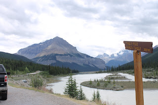
Mount Robson. This is an amazing mountain, visually stunning, and fully visible from The Yellowhead Highway.

You know what this muddy little stream is? Can you guess?

That's right, it's the headwaters of the mighty, or muddy as the case may be, Fraser River. the best salmon fishing river in the world. Ask me how I know.

Sort of home.

Heading down the Icefields Parkway, there are amazing views in almost every direction. The mountains are stunning!

Mile for mile, pound for pound, dollar for dollar, this is the best scenic drive in the world as far as I am concerned.

Glaciers everywhere, at almost every turn its a new one.

This is the toe of the Columbia Glacier, the biggest one along the route. Those little black specks on the glacier are people. The slightly larger black specks to the back are ice buggies taking people further up the glacier.

The weather changes suddenly up here. I can assure you that there are amazingly beautiful mountains behind that rain.

When the sky cleared, we found ourselves at the Bow Glacier. It has this amazing waterfall at the front which feeds into Bow Lake, and ultimately into the Bow River.

Another shot of the Bow Glacier, a bit closer up this time.

Out of Banff and past Canmore. We are headed home!

Cochrane looks much the same as we left it, cloudy with a chance of meatballs.

Now, witness the power of this fully operational battle station... er... elevator.

Tuesday, July 14, 2015

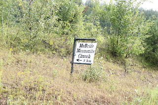
McBride, BC; That's Right.

Travel Day
  • Chetywynd, BC to Mackenzie, BC via BC-97 and BC-39 (John Hart HIghway and Mackenzie Blvd.)
  • Mackenzie, BC to McBride, BC via BC-39, BC-97 and BC-16 (Mackenzie Blvd., John Hart Highway, Yellowhead Highway)

A while after you leave Chetywind, you leave the Peace River Regional District and enter the Fraser-Fort George Regional District.

The Powder King Ski Resort is in Pine Pass, the lowest pass through the Rocky Mountains in BC. Pine Pass is the summit of the east/west  highway, but is not actually the continental divide. The vagaries of geography mean that Summit Lake, hundred kilometers or so down the road, is actually the north/south continental divide.

They were working on the road in Pine Pass. Yep, that's fire coming out of the bottom of that asphalt machine.

We took a detour up to Mackenzie, BC. It is on Williston Lake, the reservoir for the Bennett Dam.

They have this really cute garden with the "M" in the middle as you come into town.

They also have this really cool tree shredder on display. This is a logging town and they are proud of it.

There are a couple of very large mills in Mackenzie. This is a sort shed from one of them, the Canfor mill.

Heading from Mackenzie to Prince George, the road is relatively unexciting.

On the other hand, heading from Prince George down to McBride presents more and more views of the west slope of the Rocky Mountains.

Yep, we're here.

Why thank you! I appreciate it.

It wouldn't be a McBride if their wasn't a railroad in its history somewhere.